Planner's Report - Angela Mudge
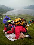
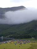
The Isle of Harris 2018 was a fitting location for the final LAMM. A wild landscape, with spectacular hills, stunning beaches and plenty of eagles. I spent 4 weeks on the Island prior to the event and can safely say the weather was horrendous for 3 of them!
Harris has Britain's largest population of golden eagles and also many white tailed eagles. The RSPB gave us a number of nesting sites and areas where they requested minimal disturbance. My first look at the map with this information caused panic. How were we going to avoid all those areas? This made planning tricky: we didn't want to cover the map with OOB areas and decided to plan routes where the majority of competitors would stick to the obvious lines which avoided sensitive areas. Also the location of the overnight camp made courses hard to plan. With courses running east west and the three main mountain ridges running north south, I had to plan routes to accommodate this.
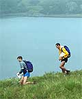
The Elite, A and Score all had the opportunity to cross Loch Langabhat, giving a teams a brief taste of Lewis and a feel for the lower terrain before heading back into the hills of Harris. I used the Loch crossing because Martin claimed there was a 'causeway' across the loch where competitors could wade across (he'd used it when he organised the Hebridean Challenge in 2002). This was a quirky feature we couldn't resist. A recce in March failed to find it, I wimped out as it was only me and the dogs on a very windy day. A recce in April failed to find it, I attempted to cross the Loch in various locations and failed, only photographic evidence of me, in chest deep water, persuaded Martin that perhaps the 'causeway' didn't exist anymore and boats were required. However, he still asked Andrew Leaney (our SI man on the event and now resident on Harris) to try again a week before the event - Andrew made it but his feet didn't touch the bottom, he swam across!
Once the location of the LAMM was set Andy Spenceley (Controller) suggested we use Crabhadail as the overnight camp. This is an amazing venue but provided us with a number of logistical problems. Getting the Score there on day one and how to get the shorter routes back on day 2 when it was over 20km in a straight line. Three scenarios were considered for day 2:
- Martin suggested starting the shorter courses on the col at the head of Loch a' Ghlinne - Andy and I were completely against this as it was miles away and didn't alter the actual distance travelled
- Finish the courses at a different location to the event centre and bus competitors home - Martin rejected this, he wanted all courses to finish at the event centre
- Use a shuttle bus to shorten the distance. A logistical challenge, but as usual Martin delivered the goods.
With the buses booked we planned for the C and D to be transported and the Score having an option. The scores were determined to coax the leading teams away from the bus and to visit higher scoring controls before heading home. The major disadvantage of this option was the 400m ridge between the bus drop off and event centre. The hillside is extremely rocky and treacherous when wet in places so a long contour round to the finish was never an option.
The weather was perfect for the event but on the hot side, this slowed courses down and I will be the first to admit they were on the long side, given the nature of the terrain. The ground was dry but I didn't fully appreciate how sapping the ground was. I'd recced most of the lower areas in boggy conditions which were even slower!
Finally I'd like to thank Andy my (fat) controller for his support, Ian and Shirley Hay, Ray Wilby, Fiona and Bill Maxwell who helped with marking the controls and hanging the kits. A very big thank you to Martin Stone for making it happen. Behind the scenes it was a logistical nightmare but as usual it went very smoothly on the day.
|