|
Planner's Report
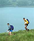
At last, fine weather for the LAMM! It may have been too hot for many of you and lacked the navigational challenges (pea soup) of recent years but I hope you all enjoyed this lovely runnable area.
This year’s area presented a few planning challenges. The western side of the area is dominated by massive, steep sided hills with very few suitable features for control sites. On several occasions I identified a potential feature on the map only to find it did not exist or was badly mapped on the ground. Therefore I tried to concentrate on route choice, rather than challenging control sites. I had to use a few Mickey Mouse features after finding the original feature was unfair.
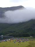
The northern side of the map proved more challenging. In low cloud these controls would have been difficult to locate, the running was slower and the ground a lot rougher. Although in the bright sunshine I think most teams breezed through the area.
I didn’t include any mega long legs on day one because the extensive path network meant that most teams would just drop down to the path, leg it and then climb back up again. Personally I prefer to run on mountains rather than the paths around them!
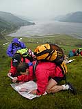
The overnight campsite was 5 star (well, maybe not the toilets!), plenty of flat, dry camping for a change. The only disadvantage was the distance from the event centre. This meant the lower courses literally followed a straight line home on day 2, whilst the Novice had the luxury of a minibus journey to their start. Originally we were going to camp in Glen Lochay but unfortunately Martin couldn’t gain permission, which meant a longer trip home for the D and C classes. I could have shortened the courses on Day one to compensate for this but reckoned the average competitor could cope!
The hills on Day two were rougher and contained several interesting features on their slopes. The area the C, D, and B visited on the slopes of Beinn Heasgarnich was very intricate. The A and E course travelled to the south of the map running along the summit ridges of Sgaith Chuil etc, where there is a lot going on, on the map. Unfortunately a few elite competitors visited a few ‘novel’ control sites after they’d mis-marked their maps!
Apologies to the D course as the winning time was more than 2 hours longer than the estimated 8 hours winning time. I hope this hasn’t put you off. I expected teams to do more contouring and didn’t appreciate how tough this course would prove to be. Next year we’ll get it right! The other courses appeared to be the right length and it would be interesting to see how quickly you would all go in cooler conditions.
I spent a lot of time in the area and am fortunate enough to live just over an hour away, so had several long runs in the hills to suss out legs, running conditions and control sites. I managed to bag Creag Mhor 4 times in the months leading up to the LAMM – so won’t be rushing back for a few weeks!
I’d like to thank Andy Spenceley for controlling the event, for his non stop chatter, useful comments and moving a few control sites when I had missed the obvious. Martin for letting me loose on the map and Dave Coustick for hobbling round to help hang kites. A special thanks to all the marshalls who helped collect in controls during the event. This help is invaluable and saves me visiting a control for the 3 rd time.
Finally I’d like to apologise on behalf of Arkle, my dog, who apparently ran off with someone’s bacon on Sunday morning – I think she felt hard done by, having visited all the control sites and getting no credit for it!
I hope to see you all at LAMM 2008 and hope you enjoyed the tamer hills of the central highlands.
Angela Mudge
|